How to Hike Mount Elbert, the Highest Mountain in Colorado
Not only is Mount Elbert the highest mountain in Colorado, but it’s also the highest in the Rocky Mountains! It’s an incredible hike for anyone looking for a long, challenging, and rewarding hike.
Since it’s a class 1 mountaineering route, it has very low exposure and low rock fall potential and is easy to navigate.
In this post, we’ll cover the different routes available to hike Mount Elbert, 14er tips and safety info, parking, how to get an early head start, and more. You don’t want to miss this post if you’re planning a trek up this incredible mountain! Especially if you’re new to hiking 14ers.
F.A.Q.
What is Mount Elbert’s elevation?
14,439 feet.
What is the parking like at Mount Elbert?
The exact details depend on the trailhead. We’ll cover the parking situation for each one in the trails section further in the post.
Keep in mind that 14er parking lots do tend to fill up fast. The earlier you arrive, the better.
How much elevation gain is required for hiking Mount Elbert?
A LOT. But the exact numbers depend on the trailhead. We’ll go deeper into each one later in the post, but here’s a quick look at the numbers:
Northeast Ridge
This is the standard route to hike Mount Elbert. It requires about 4,500 feet of elevation gain.
East Ridge
A high-clearance 4WD vehicle or OHV is needed for this route. It requires about 4,100 feet of elevation gain.
Southeast Ridge
The southeast ridge is the longest and hardest route up Mount Elbert. It’s a class 2 route that requires about 5,300 feet of elevation gain.
How difficult is Mount Elbert?
No matter the route, Mount Elbert is a challenging hike. The exact difficulty will depend on your fitness level, style, and mountaineering experience.
Mount Elbert’s more popular trails (not including the Southeast Ride/Black Cloud) is a class 1 route, meaning it has low exposure* and little to no scrambling. However, it does have LONG stretches of very steep trail with loose dirt and scree*.
I saw a few people, including my fiance, slip and fall on the descent. Luckily, since it’s low exposure, they weren’t at risk of falling off the mountain on these slippery spots. But, it is rocky and falls here have the potential to cause broken bones.
Good mountaineering boots with excellent traction are highly recommended here. Hiking poles are also very helpful. Although scrambling isn’t required, I’d recommend using your hands to stay steady on sections of the trail with steep descents and loose rock.
For Experienced Mountaineers
Experienced mountaineers should have a better idea of how challenging this trail will be for them! The challenge isn’t from the technicality of the hike or scrambling, which there is little to no of. The challenge for this hike is the distance and elevation gain, no matter the route.
*Explanation of terms for our new mountaineering friends:
Exposure: Exposure describes how at-risk you are for a severe fall. For example, a highly exposed route may involve walking on a narrow section of a trail with high drop-offs on either or both sides of the trail. Falling here would cause serious injury and possibly even death.
Scree: Scree is the accumulation of loose stones, gravel, and dirt that form on a mountain.
What Mountain Range is Mount Elbert in?
Mount Elbert is in the Sawatch Range, within the Rocky Mountains in Colorado.
Where can I find a trail map for Mount Elbert?
You can find an interactive trail map of all Mount Elbert routes here on 14ers.com. You’ll need to make a free account to access the interactive trail maps. However, this is super easy and free to do.
What is the closest town to Mount Elbert?
The closest towns to Mount Elbert are Leadville and Twin Lakes, depending on the trailhead. Leadville is the place to go to fill up on a delicious meal before or after your hike. It has a wonderful downtown district with plenty of restaurants to choose from.
I highly recommend Moe’s Original Barbecue for an after-hike meal. Please share any recommendations you have in the comments section!
Colorado 14er Safety Tips
Keep in mind all 14ers vary. The exact safety measures needed will depend on the specific route and mountaineering class. These are the tips I recommend for this specific route, but they should also be applied to all others!
After reading this list, I highly recommend you dig into the additional resources listed below.
Start Early (Like REALLY early)
The golden rule of mountaineering in Colorado is to be off the summit by noon. The Mountains here have near-daily afternoon thunderstorms. They’re very dangerous to be caught in while above the treeline because of the heightened risk of being struck by lightning.
Additionally, trailhead parking fills up fast here, even on challenging trails. During the weekend, it’s not uncommon for trailhead parking to fill up by 5 a.m. Luckily, a lot of trails have overflow parking. The Mount Elbert Northeast Ridge happens to have lots of roadside parking.
Acclimate to the altitude beforehand
Altitude sickness is common while hiking 14ers, even for someone who has acclimated. However, if you’re coming from out of state and have not acclimated, your risk for altitude sickness and its severity increases significantly.
So, if you’re traveling from out of state, make sure to spend several days acclimating to the altitude before hiking any 14er.
For Mount Elbert, it’s a great idea to spend the day (or days!) leading up to the trek in a nearby town such as Leadville or Twin Lakes. This will help you acclimate even more since both towns are at a much higher elevation than more popular areas like Denver or Colorado Springs.
Bring more than enough snacks and water
Food and water are your BBFs while mountaineering. Always bring more than you need, even if it adds some weight.
The last thing you want is to be high up on the mountain, miles away from the trailhead, starving and dehydrated. Not only is it uncomfortable, but it’s very dangerous.
Keep munching on small snacks frequently on your hike. Food helps provide you the energy you need to keep going on a trail like this. Additionally, you don’t want to eat larger, infrequent meals on the trail because they can get heavy and bog you down.
There isn’t a good water source along the trail for the Mount Elbert standard route. There is a creek close to the beginning of the trailhead, but that’s about it. Please keep this in mind if you typically collect your water along the trail. Make sure to fill up on enough water at the beginning!
Additional Resources to Learn About 14er Safety:
An article about mountaineering safety on 14ers.com
10 Tips for Climbing Your First Colorado 14er by SCL Health
How to Hike Mount Elbert
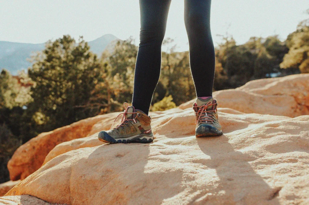
What to Pack
- More than enough snacks and water
- First Aid Kit
- Hiking Poles (Trust me, you will be so thankful to have these on the descent)
- Small, lightweight backpack (I highly recommend one with a water reservoir)
- Wind-resistant jacket, gloves, and a beanie (even in the middle of July, expect the summit to be cold and windy)
- Light source, such as a headlamp
- Sun protection (the higher in elevation you go, the more intense the sun becomes! Even if it’s simultaneously cold and windy)
- Sunscreen
- Hat
- Sunglasses
- Emergency Blanket
- Rain Poncho
What to Wear
- Wear quick-dry clothes (no cotton!)
- Plenty of layers. In summer, wear a tank top or lightweight t-shirt with another overshirt, such as flannel.
- Wind-resistant jacket (if you’re not already packing it)
- Comfortable shoes with good traction
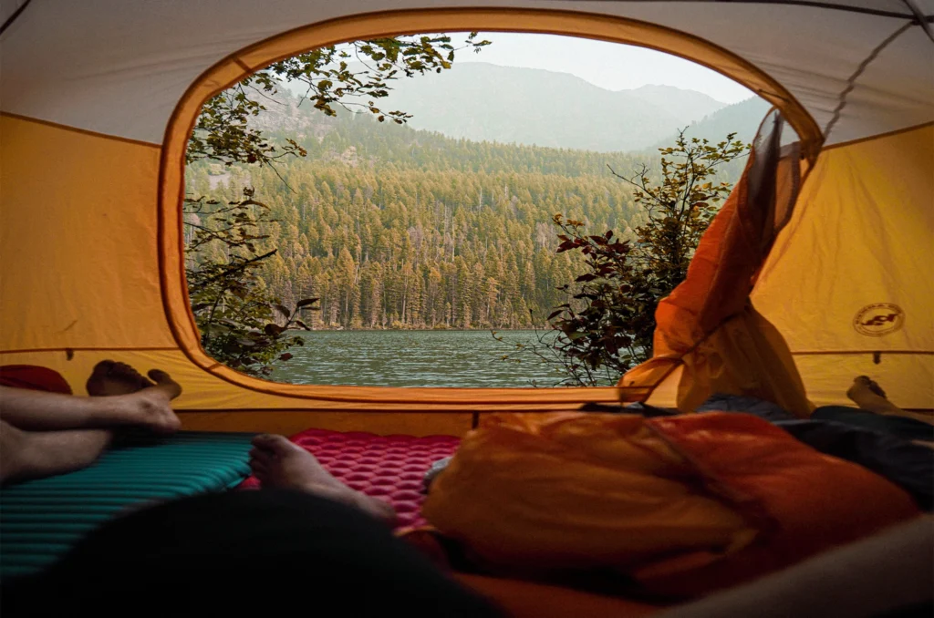
Camp Near the Trailhead
The key to an early start is to camp near the trailhead. That way, all you have to do is roll out of bed, grab your things, and hit the trail.
Colorado’s most popular cities are 2+ hours away. So, to get to the trailhead by 5 a.m., you’d need to leave by 3 a.m. if you’re coming from Denver. It’s even longer if you’re coming from Colorado Springs, Boulder, or Fort Collins.
Luckily there are campsites available close to each Mount Elbert trailhead! We’ll dive into that further for each trail.
Mount Elbert Trails
Mount Elbert has three hiking routes to the summit, plus an additional snow climbing route. The Northeast Ridge Trail is the standard route and the only one I have hiked. We will go into detail about what to expect on the standard trail, then touch on all the others!
Mount Elbert Northeast Ridge Trail (Standard Route)
Distance: 9.75 miles
Elevation Gain: 4,500 ft
Mountaineering Class: 1
The Northeast Ridge trail is the standard route for Mount Elbert. It’s the only one I have personally hiked, and I must admit, it was MUCH more challenging than I expected!
The listings on AllTrails and 14ers.com have the route listed at 9.75 miles roundtrip. However, my fitness watch tracked a whopping 15 miles from the trailhead and back when I hiked it! Yes, I did hang out at the summit for a while, but I knew I was in for a longer day than expected when I got to the treeline and saw how long and steep the remainder of the trail was.
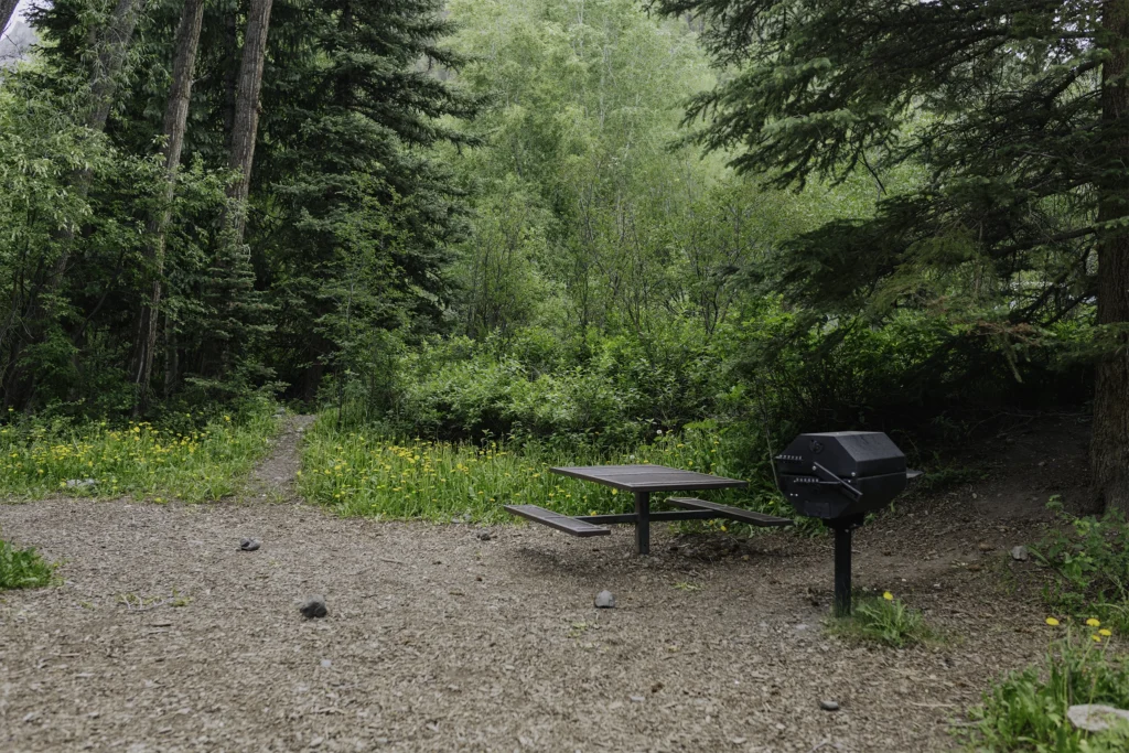
Camping near the Mount Elbert Northeast Ridge Trail
If you look on Google Maps, you’ll see two established campgrounds: Elbert Creek and Halfmoon East Campground. Both campgrounds have Vault Toilets, limited sites, and require a fee. Of these two, I’d recommend Elbert Creek because it’s across the street from the Mount Elbert Trailhead.
What I really recommend, however, is staying in the dispersed camping area that encompasses the majority of Halfmoon Road. Sure, you won’t have toilets. But it’s completely free! Since it’s a national forest, you can camp anywhere on public property that doesn’t have a “no camping” sign.
Mount Elbert Northeast Ridge Trail Parking
The Mount Elbert Northeast Ridge trailhead has a decently sized parking lot that can fit about 30 to 40 cars. When it fills up, there is plenty of overflow parking along the side of Halfmoon Road. I wouldn’t worry too much about not finding a place to park near the trailhead. However, the earlier you get there and can find a good parking spot, the less extra walking you’ll have to do to reach the trailhead.
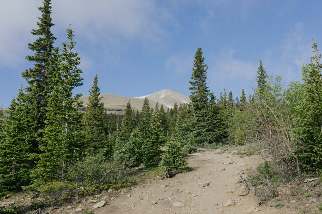
The Ascent, Part 1: The Forest
The trailhead begins on Halfmoon Road, next to the Elbert Creek Campground. There is a small creek that flows nearby. If you plan to collect water on the trail, this is the time to do it. There isn’t a water source past this.
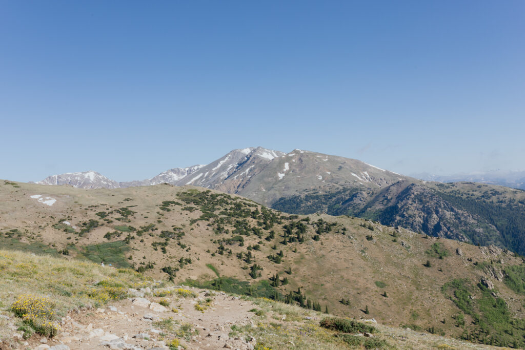
For the first three miles, you’ll walk through a lovely forest. There is a slight incline during this part of the hike, but nothing like what you’ll experience above the treeline! This is the easy portion of the hike.
The Ascent, Part 2: Above Treeline
Once you get above the treeline, get ready for the challenge! The final two miles to the top require steep elevation gain and lots of loose scree. During this section, hiking poles and mountaineering boots are a major help.
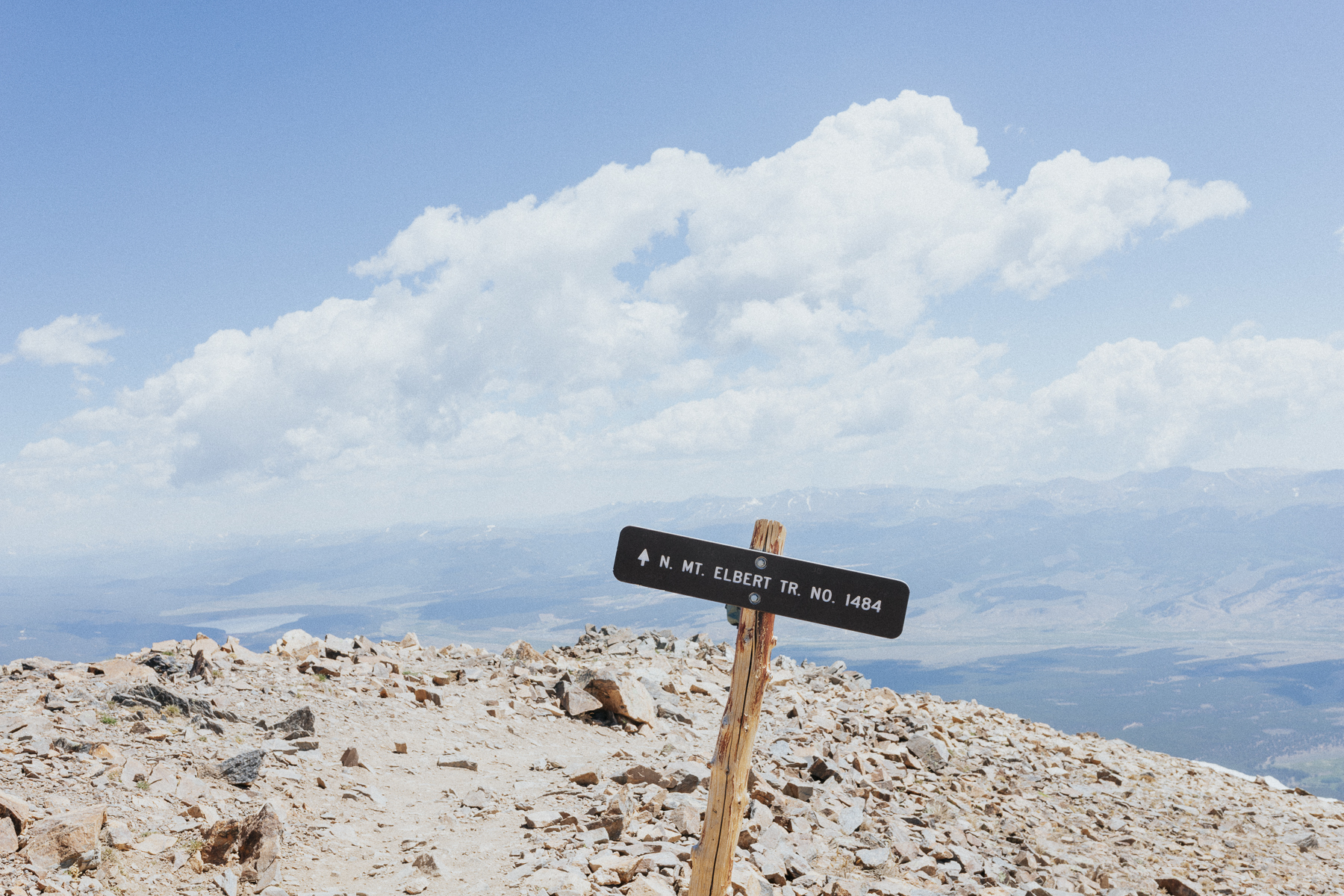
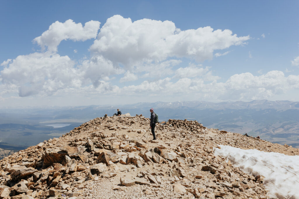
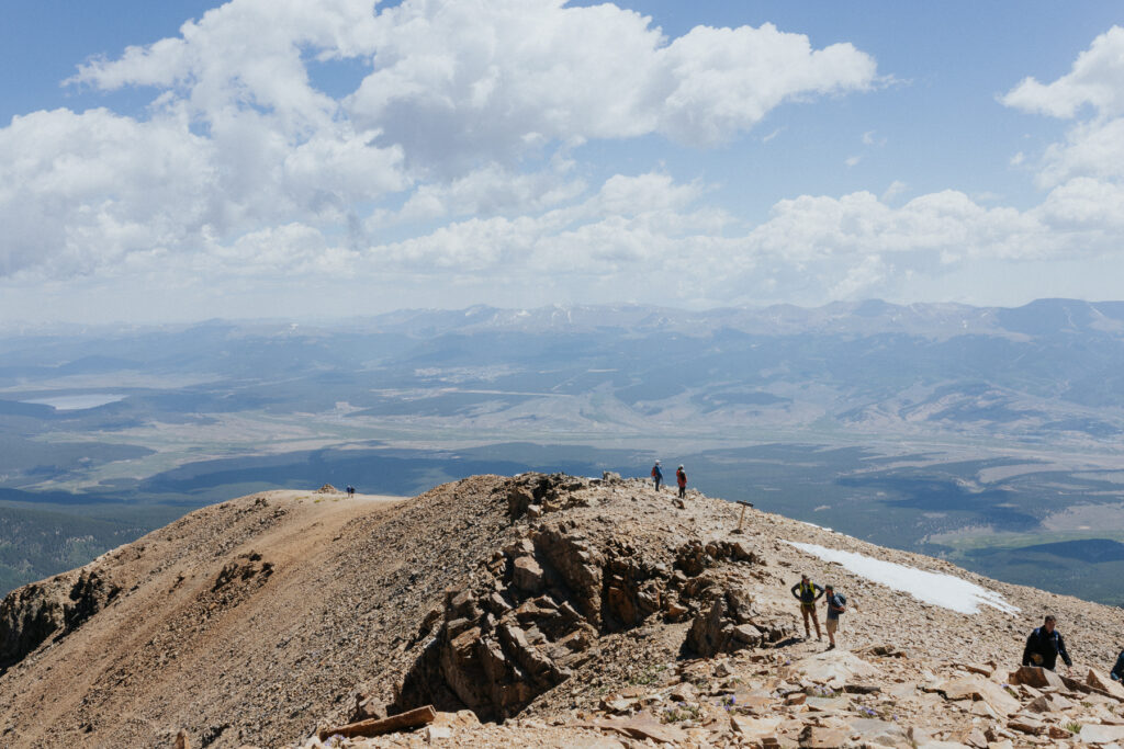
Keep in mind Mount Elbert has two false summits! You won’t be able to see the actual summit until you make it to the top of the second false one. I was unaware of the second false summit when I hiked Mount Elbert. This was a huge pain point for me (and others on the trail, too!). Just keep this in mind while hiking it. Know that what appears to be the summit when you first get above the treeline is not it. It’s even further away!
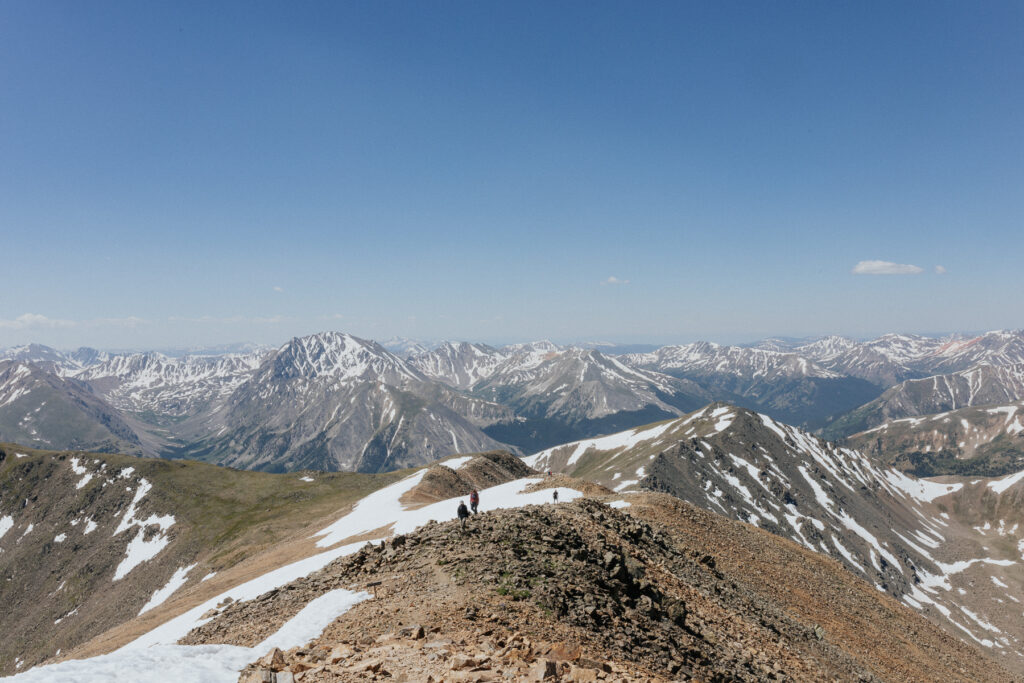
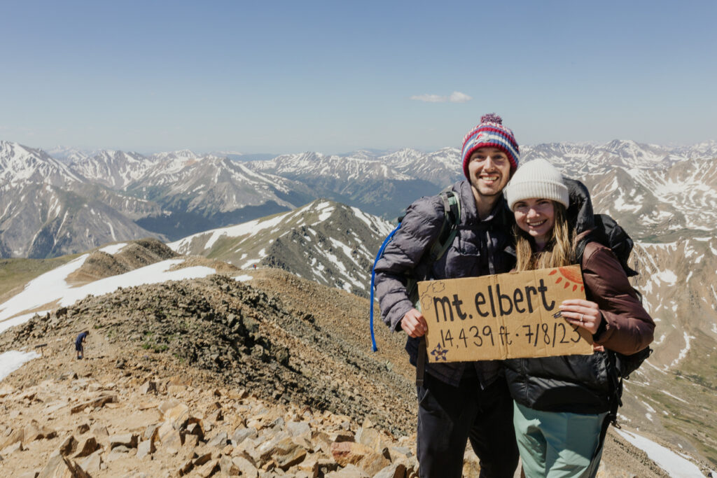
Mount Elbert’s Summit
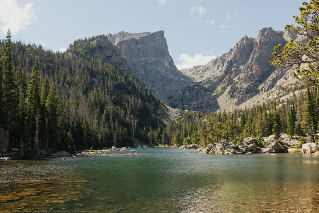
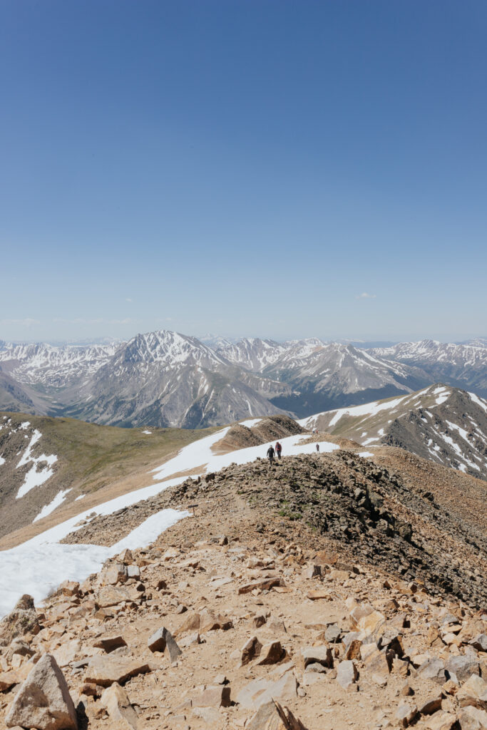
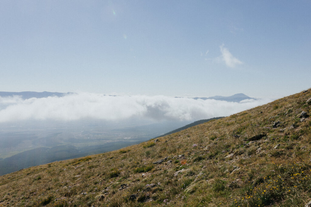
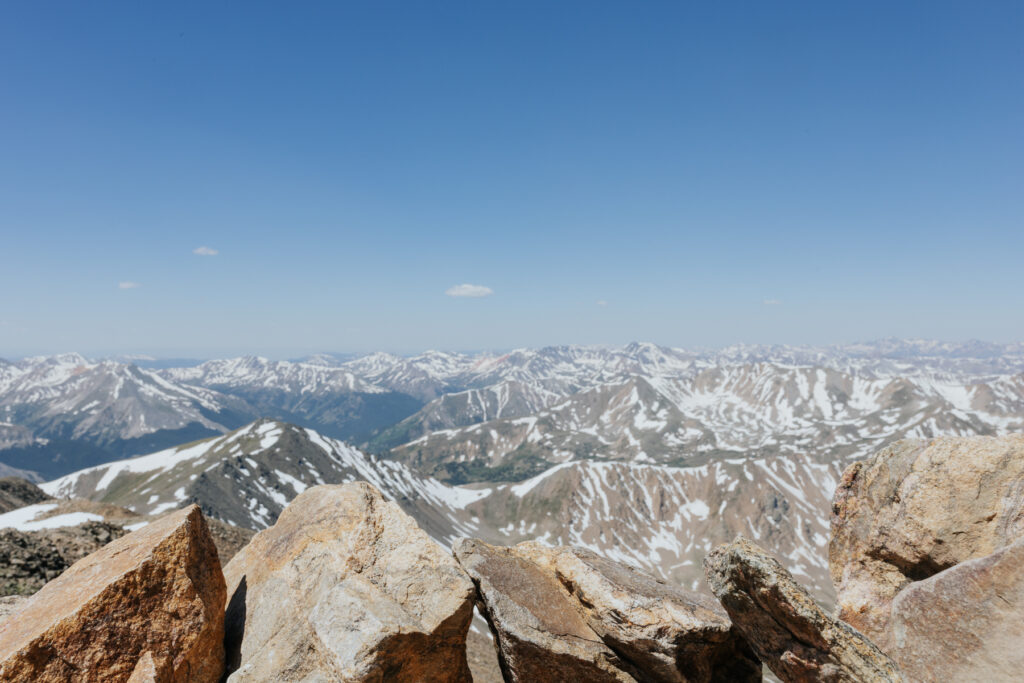
The views from the top of Mount Elbert are incredible. I mean, you’re literally standing at the top of the Rocky Mountains! You can see the tops of other mountain peaks from miles and miles away. On the south side, you can see the beautiful Twin Lakes.
I recommend taking some time at the top to relax and enjoy the views. Bring lunch and maybe a summit beer if that’s your style! I always bring my camera to take lots of photos from the top.
The Descent
Even without the need for scrambling, the descent can be tricky for those new to mountaineering. It’s steep with lots of loose scree. I saw several people slip and fall, including my fiancé.
You don’t really have to worry about falling off the mountain, but still be careful. It’s very rocky, and hiking down with a sprain or broken bone would be an awful experience!
Like the hike up, the descent through the forest is easy. The trail is smooth and not too steep. It’ll be a welcomed change after the portion of the descent above the treeline!
Scroll to the bottom of the post to see what to do after you finish the hike!
South Mount Elbert Trail
Distance: 14.5 miles
Elevation Gain: 4,900 ft
Mountaineering Class: 1
The South Mount Elbert Trail is the longest of all the routes. It starts in Twin Lakes, right next to the Lakeview Campground. It’s an excellent option for those wanting a 14er + lake day combo weekend.
With the abundance of parking and campsites on the standard route, I would choose that over the additional five miles of hiking for this trail.
However, if you have a high-clearance, 4-wheel drive, you may be able to access the same trail from a closer trailhead called the East Ridge. More on that in the next section!
South Mount Elbert Trail Parking
There is a medium-sized parking lot at the South Mount Elbert Trailhead. If it’s filled up when you get there, you can look for a place to park in the national forest dispersed camping area next to the parking lot.
Camping near the South Mount Elbert Trail
You’ll have many options when camping near the South Mount Elbert Trail! There’s an established campsite with amenities right next to the parking lot, plus several more around the lakes.
Additionally, there is a ton of dispersed national forest camping on the north side of the parking lot. Explore roads 24, 125B, and 122 to find a camp spot.
Mount Elbert East Ridge Trailhead
Distance: 10.5 miles
Elevation Gain: 4,100 feet
Mountaineering Class: 1
The Mount Elbert East Ridge Trailhead is along the South Mount Elbert Trail listed above. It’s located about 2 miles past South Mount Elbert.
With this in mind, I’m sure you’re wondering why anyone would start at the South Mount Elbert Trailhead instead of this one.
Well, to get to the East Ridge Trailhead, you’ll need a high-clearance vehicle with four-wheel drive. The road is rough, with large rocks and potholes. We tried getting to this trailhead in a 4WD Mazda CX5 and nearly got stuck!
However, if you can make it to the trailhead, I’ve heard this route is amazing! It’s also typically less busy than the standard route since the primary trail is much longer, and you need a specialized vehicle to reach the East Ridge Trailhead.
Mount Elbert East Ridge Trail Parking
There is a parking lot at the trailhead, plus overflow parking along the road. Since this trailhead is inaccessible to most vehicles, it doesn’t fill up as quickly as other trailhead lots.
Camping near the Mount Elbert East Ridge Trail
Due to how close it is to the South Mount Elbert Trail, the campsite locations are pretty much the same! With some additional (and more remote) options.
There are dispersed campsites along the 4-wheel drive road leading to the East Ridge Trail. In fact, you can even camp right next to the trailhead. Like the parking situation, there’s typically plenty of space here, and it doesn’t tend to get too busy.
Mount Elbert Southeast Ridge via the Black Cloud Trail
Distance: 11 miles
Elevation Gain: 5,300 feet
Mountaineering Class: 2
For a less crowded and even more challenging route up Mount Elbert, check out the Black Cloud Trail. It begins west of Twin Lakes and climbs an incredible 5,300 feet of elevation gain.
Black Cloud Trail Parking
The Black Cloud Trail parking lot is very small. You’ll want to get here extra early or car camp the night before to get a spot. There aren’t any campsites near the trailhead, but I’ve heard there are some dispersed campsites along the trail if you want to backpack in.
Camping near the Black Cloud Trail
The closest established campground to the Black Cloud Trail is the Twin Peaks Campground. Visitors can also stay at the Mount Elbert Lodge, which offers private cabins next to the trailhead.
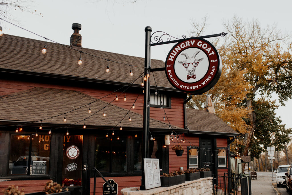
Visit Leadville for a Great Meal After the Hike
After the hike, you’ll definitely want a large, hot meal! I highly recommend checking out a restaurant in downtown Leadville, the closest town to the standard trailhead. Twin Lakes is also nearby, but it has few food options.
Leadville has a cute downtown area filled with small mountain town charm. There are plenty of food options here, plus shopping if you can manage to keep walking!
My favorite place to eat in Leadville after a hike is Moe’s Original Barbecue. It’s sooo good and will provide the protein and other nutrients you need after a long mountain trek. Additionally, it’s outdoors and super laid back. You’ll be totally fine if you’re a bit disheveled and not smelling your best after this massive hike!
Other great places to eat in Leadville after a hike include:
- High Mountain Pies (pizza)
- Casa Blanca (Mexican)
- Wild Bills (burgers)
What are your favorite places to eat in Leadville? Please share them in the comments below! Noting that I’m purposefully not listing ‘fancier’ restaurants that may not be appropriate to visit after a long hike.