Longing for a Rocky Mountain National Park Hike? Here are the 9 Best Places to Go
Rocky Mountain National Park » Best Places to Hike
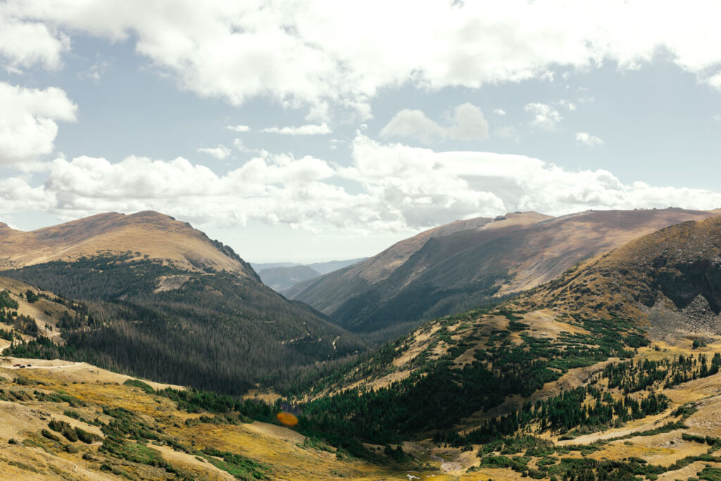
Rocky Mountain National Park is one of my favorite places to hike. The park has over 355 miles of hiking trails with varying views and terrain. There’s something for everyone here. Whether you want a short lakeside stroll, to summit a rugged peak, or something in between, you’ll find it here. The park has everything from lush forests and meadows to high mountain peaks and alpine terrain.
Rocky Mountain National Park has hundreds of excellent trails – way too many to accurately list “the best.” Instead, this post goes over the best regions to hike in. Some of these are officially known regions, such as the Wild Basin and Kawuneeche Valley. Others are small areas that make sense to group together.
Each region listed includes suggested hikes. Easy, moderate, and difficult trails are curated from each area. The recommended trails are a mix of hikes I love and have exceptionally high reviews. Each recommended hike has a link to AllTrails. There, you’ll be able to learn more about each specific trail.
9. Next to Grand Lake
Grand Lake has two lesser-known trailheads leading into Rocky Mountain National Park; The North Inlet Trail and East Inlet Trail. Both trails are long, but you’ll find immense natural beauty early on. In fact, the picture above was taken about a mile into the East Inlet Trail. Keep an eye out for Moose and Black Bear in this area.
Adams Falls is half a mile into the East Inlet Trailhead. After that, it gets increasingly secluded. You’ll meander through a beautiful open valley surrounded by mountains for the first 2.5 miles. Eventually, you’ll start hiking into the mountains towards a series of lakes.
If none of the trails below match the length you’re going for, look up variations of both trails. I can guarantee you’ll find something!
Recommended Hikes
East Inlet Trail to Spirit Lake | Difficult | 15.7 Miles
East Inlet Trail to Lone Pine Lake | Moderate | 10.4 miles
East Inlet Trail to East Meadow Camp | Moderate | 2.4 miles
Cascade Falls | Moderate | 7.4 miles
Tonahatu Creek Trail to Big Meadows | Moderate | 8.9 miles
Adams Falls Trail | Easy | 0.8 miles

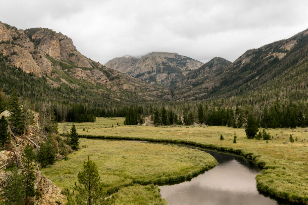
8. Kawuneeche Valley
The Kawuneeche Valley runs 22 vertical miles on the park’s west side. Moose, elk, and other wildlife frequent this lush green area. The Never Summer Wilderness and Mountains sit on the valley’s west end. The valley is open year-round. However, the northern section of Trail Ridge Road closes during winter.
The Kawuneeche Valley is home to several historic sites, such as Holzworth Ranch and Lulu City. Most of the trails meander through the meadows, but some go up into the Never Summer Mountains.
Recommended Trails
LaPoudre Pass | Difficult | 14 miles
Little Yellowstone | Moderate | 12 miles
Lulu City Trail | Moderate | 7.8 miles
Shipler Cabin | Moderate | 4.1 miles
Coyote Valley Trail | Easy | 2.1 miles
Holzwarth Historical Site | Easy | 1.2 miles
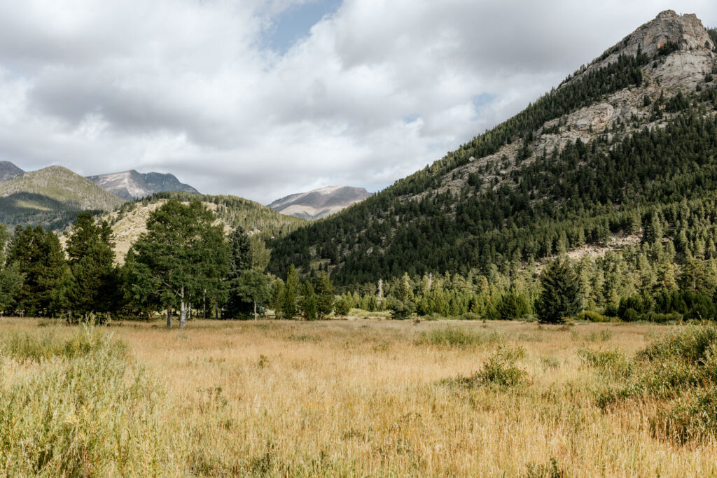
7. Deer Mountain & Beaver Meadows
Deer Mountain & Beaver Meadows are lower-elevation areas on the park’s east side. Deer mountain and the surrounding valley are within the loop connecting both east-side entrance stations. You’ll find Beaver Meadows southwest of the loop.
You’ll see LOTS of elk in this area. It’s where the majority of the herd spends their time. Open green meadows are broken up by mountains covered in Ponderosa Pine. It’s a lovely forested area with plenty of wildlife.
Deer Mountain is the most popular hike in this area. It’s considered an excellent warm-up hike for visiting the park. Trailheads to Deer Mountain are close to both eastern entrance stations, making it easy to access for people coming from the front range.
Recommended Trails
Beaver Meadows to Ute Trail | Difficult | 12.7 miles
Deer Mountain Trail | Moderate | 6 miles
Beaver Mountain Trail | Moderate | 4.1 miles
Upper Beaver Meadows Loop Trail | Moderate | 1.1 miles
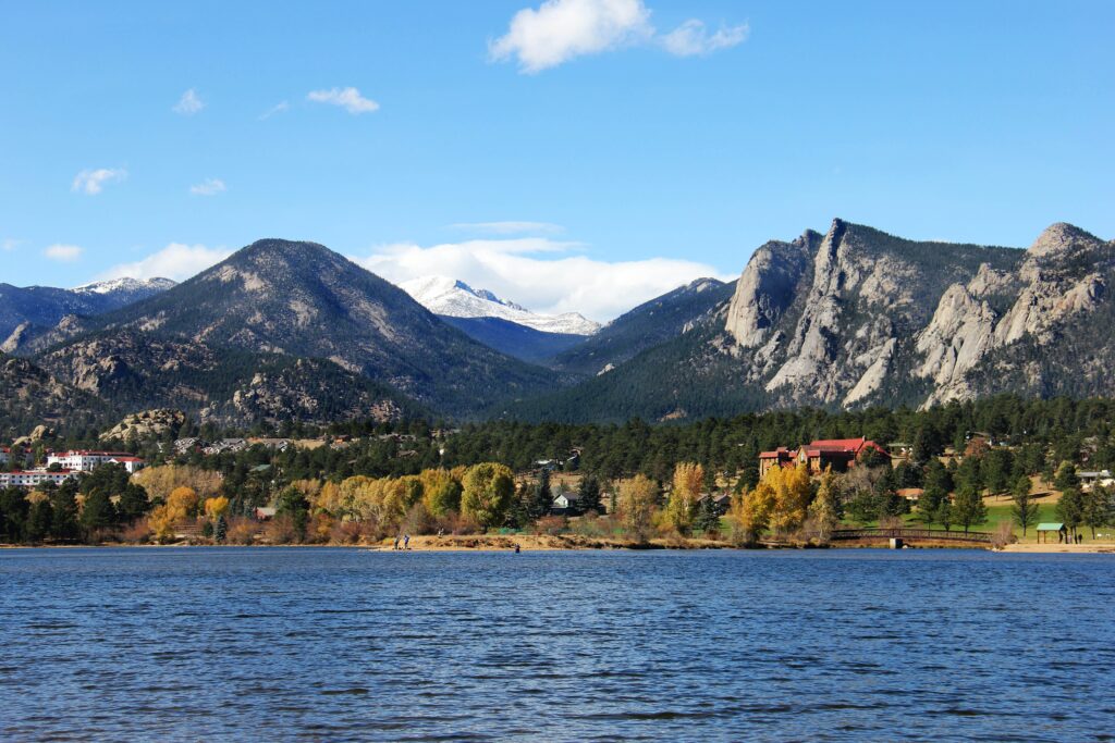
6. North of Estes Park
The area North of Estes Park is technically part of the Northern Wilderness Region. However, these trails are easier to access than the ones starting on Old Fall River Road. This is why I wanted to give them their own section.
You don’t need to go through an entrance station for these trails. Unless you’re coming from the west side, that is. The trailheads start just north of Lake Estes and the Stanley Hotel. Expect beautiful lakes and waterfalls in this area.
Recommended Trails
Bridal Veil Falls via Lumpy Ridge Trails | Difficult | 15.3 miles
Black Canyon, Dark Mountain, Cow Creek, Gem Lake Loop | Difficult | 15.7 miles
Gem Lake and Lumpy Ridge Loop | Moderate | 4 miles
MacGregor Falls Trail | Moderate | 4.4 miles
Black Canyon Trail | Moderate | 7.4 miles
Twin Owls and Lumpy Ridge Loop | Easy | 1.6 miles
5. Northern Wilderness
The Northern Wilderness is the expansive and rugged area north of Fall River and Old Fall River Roads. The incredibly long trails make it an excellent place for backpacking.
Most of the trails in this area are considered difficult. There’s a good reason it’s officially labeled the Northern Wilderness. The Mummy Mountain Range, which has several peaks above 13,000 feet, is in this area.
Recommended Trails
Crystal Lakes Trail | Difficult | 14.5 miles
Mount Chapin, Mount Chiquita, and Ypsilon Mountain Loop | Difficult | 8.9 miles
The Saddle Trail | Difficult | 15.9 miles
Lawn Lake Trail | Difficult | 13 miles
Ypsilon Lake Trail | Difficult | 8.9 miles
Chapin Pass Trail to Mount Chapin | Moderate | 3.9 miles
Mount Chiquita via Chapin Pass Trail | Moderate | 5.1 miles
Alluvial Fan | Easy | .5 miles
4. The Wild Basin
Rocky Mountain National Park’s southwest corner is known as the Wild Basin. It’s a lesser-known area with waterfalls, lakes, expansive mountains, and many plants and wildlife. The Wild Basin is a fantastic choice if you’re looking for a more secluded experience. You don’t need to go through an entrance station to access it.
Recommended Trails
Bluebird Lake Trail | Difficult | 4.3 miles
Wild Basin Trail to North St. Vrain Campsites | Difficult | 4.7 miles
Lion Lake Trail | Difficult | 12.4 miles
Finch Lake and Pear Reservior Trail | Difficult | 13.4 miles
Ouzel Lake Trail | Moderate | 10 miles
Wild Basin Trail to Allenspark Trail | Moderate | 9.2 miles
Calypso Cascades via Wild Basin Trailhead| Easy | 3.5 miles

3. Alpine Region
The Alpine Region is one of the most unique areas of the park. Arctic and alpine tundra cover this high-elevation region. You’re surrounded by peaks as high as 12,933 feet.
I love this area because it has something for everyone. It includes the high-elevation area along Trail Ridge Road that is easily accessible to visitors. The short hikes here make it so almost anyone can experience walking through alpine terrain.
The adventure-seekers will love the mountains south of Trail Ridge Road. These beautiful peaks and alpine lakes can only be reached after a long hike across rugged terrain. Mount Ida is the most popular hike in this region. However, Mount Julian has the highest peak.
Recommended Trails
Mount Ida Trail | Difficult | 9.3 miles
Azure Lake and Inkwell Lake Loop | Difficult | 11.1 miles
Peak 12150 via Ute Trail | Difficult | 5.7 miles
Timber Lake Trail | Difficult | 10.9 miles
Ute Trail to Tombstone Ridge | Moderate | 5.7 miles
Ute Trail from Poudre lake to Alpine Ridge | Moderate | 8 miles
Tundra Communities Trail | Easy | 1.1 miles
Alpine Ridge Trail | Easy | 0.7 miles

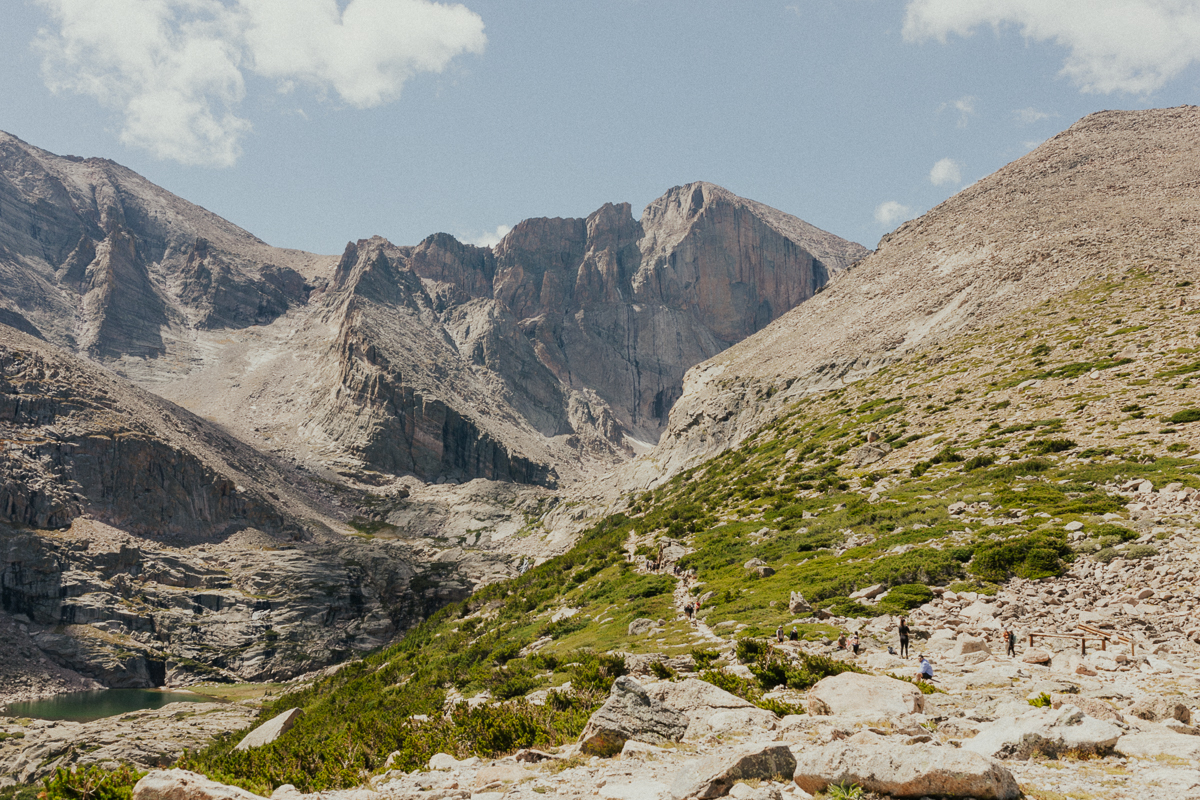
2. Longs Peak Trailhead
The Longs Peak Trailhead is on the park’s east side between the Beaver Meadows Entrance Station and the Wild Basin.
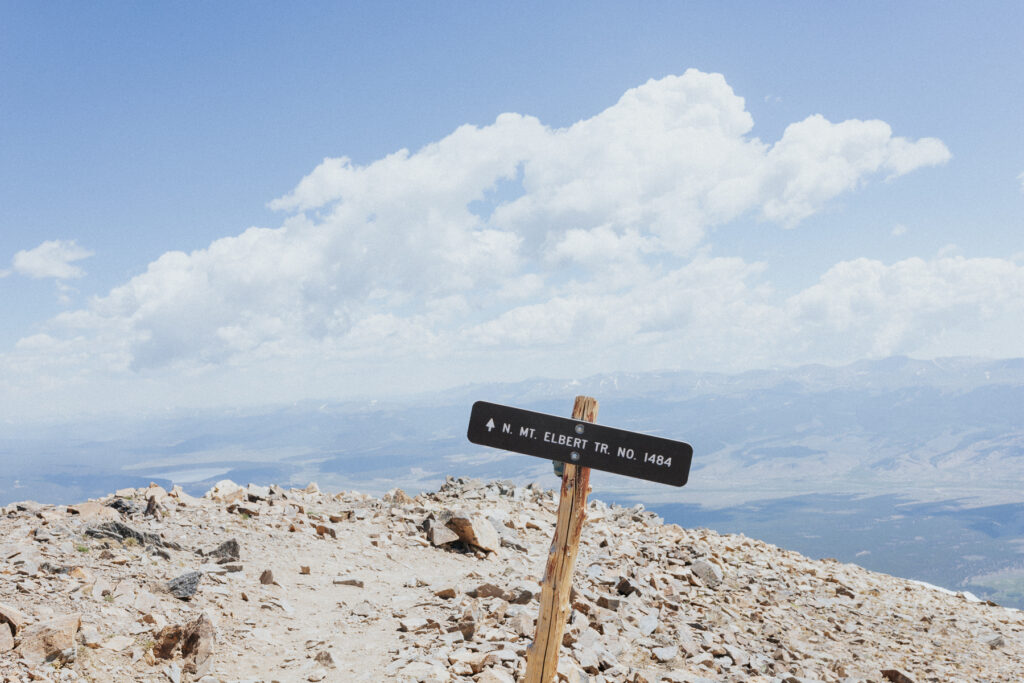
Longs Peak is the tallest in the park at 14,259 ft. It’s one of Colorado’s 56 14ers, or, mountain peaks over 14,000 ft. The tallest mountain in Colorado is Mount Elbert, at 14,439 ft. That’s less than a 200ft difference.
Warning: Do NOT attempt Longs Peak or Mount Meeker if you don’t know what you’re doing. Even experienced mountaineers have died on Longs Peak. Unless you have hiked other 14ers, are okay with starting the hike by 3am, and have the proper equipment, please don’t do it.
However, you can still get close to Longs Peak on a challenging but less extreme hike. Chasm Lake, pictured above, sits right below Longs Peak. It’s a difficult trail that requires traversing through tundra and scrambling up a rock wall toward the end.
Recommended Trails
Chasm Lake | Difficult | 5.8 miles
Longs Peak | Difficult | 14.5 miles
Mount Meeker | Difficult | 13.2 miles
Mount Lady Washington | Difficult | 8 miles
Battle Mountain | Difficult | 7.1 miles
Estes Cone via Eugenia Mine and Longs Peak | Moderate | 6 miles
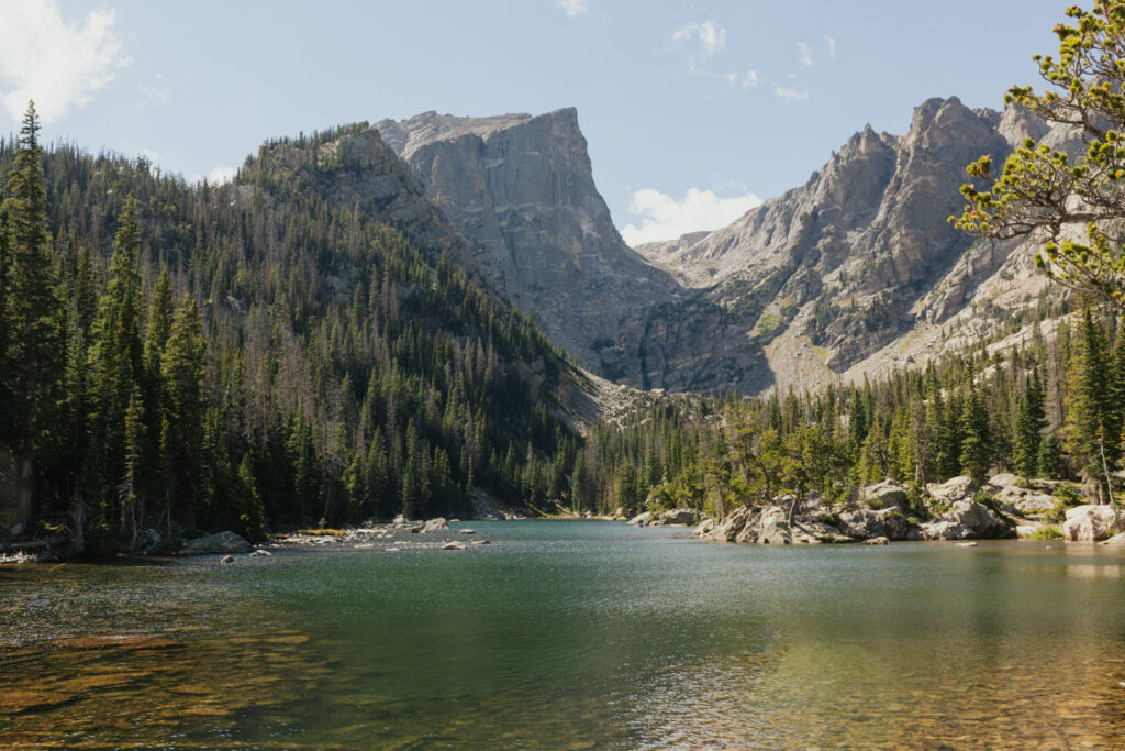
1. The Bear Lake Road Corridor
The Bear Lake Road Corridor is home to some of the park’s most beautiful hikes and alpine lakes. That being said, it’s also the busiest area. During the busy season, you’ll need to get a timed entry permit IN ADDITION to the one to enter the primary part of the park.
The Bear Lake Road Corridor has a range of hikes for varying skill levels – from the wheelchair-accessible Sprague Lake to a 9.4-mile hike that involves scrambling up a waterfall towards the end.
If you’re interested in the Bear Lake Road Corridor, you have to check out this post, where I go into MUCH more detail on all the best hikes in the area.
Recommended Trails
Skypond via Glacier Gorge | Difficult | 9.4 miles
The Loch via Glacier Gorge | Moderate | 5.4 miles
Lake Haiyaha | Moderate | 4 miles
Mills Lake | Moderate | 5.4 miles
Fern and Odessa Lakes | Moderate | 9.3 miles
Emerald Lake Trail | Easy | 3.2 miles
Alberta Falls Trail | Easy | 1.6 miles
Bear Lake Nature Trail | Easy | 0.7 miles

Comments ( 1 )
10 Fun Things to Do in Rocky Mountain National Park this Summer
June 26, 2023 at 5:47 pm
[…] For more information, check our post on the best places to hike in Rocky Mountain National Park. […]